


 Print
Print Save
Save
 Share
Share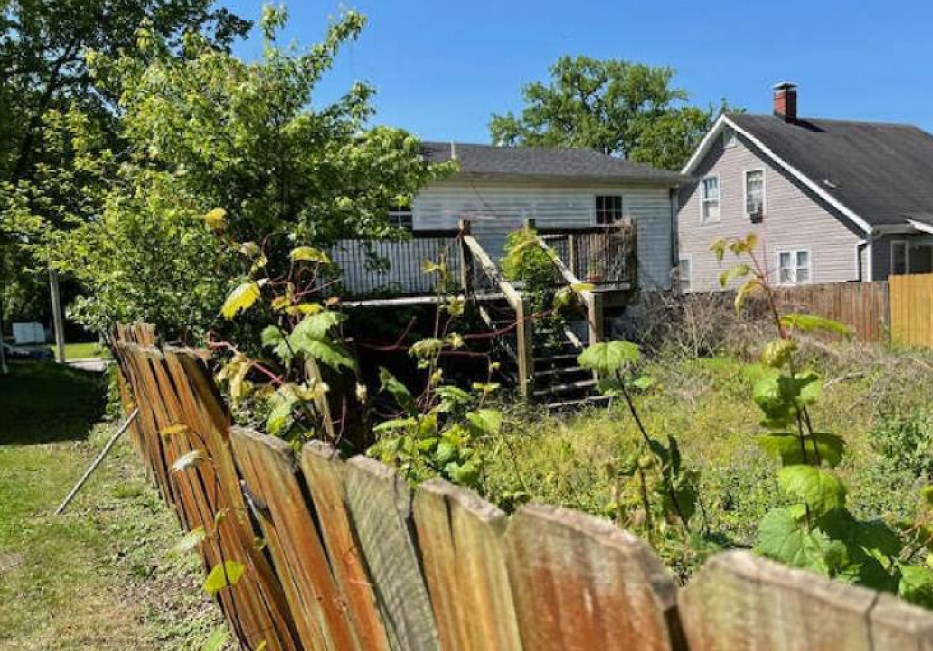
SPECIAL NOTES
- This transaction is NOT contingent on financing.
- Seller to pay Taxes, HOA, and Municipal/Utility Liens.
- Buyer will be responsible for the payment of all UCC liens of record on the property.
- Bids below the reserve may be presented to the seller for consideration.
- Please read the Williams and Williams disclaimers carefully before placing a bid or submitting an offer.
- Buyer will not be charged a Buyers Premium or Auction Service Fee
- Buyer's Agent Commission: Please Contact for Commission Scale.
- Buyer is responsible for all escrow and closing fees typically ranging from $750-$3000. It is the Buyer's responsibility to contact a local title agency or real estate attorney for a property specific estimate prior to placing a bid.
- Closing must occur on or before 30 days from seller's acceptance of offer.
- Buyer is responsible for obtaining possession of the property after closing.
- The property is being offered As-Is, Where-Is, without any contingencies.
- Seller will agree to transfer title via Special Warranty Deed (or jurisdictional equivalent) if buyer secures title insurance, at buyer's expense, without delaying the closing date. If buyer does not purchase title insurance, Seller will transfer the property via quit claim deed (or jurisdictional equivalent).
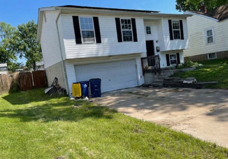
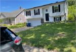
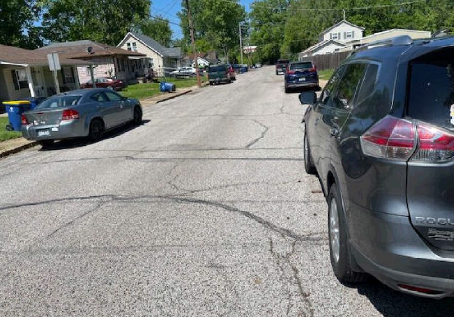
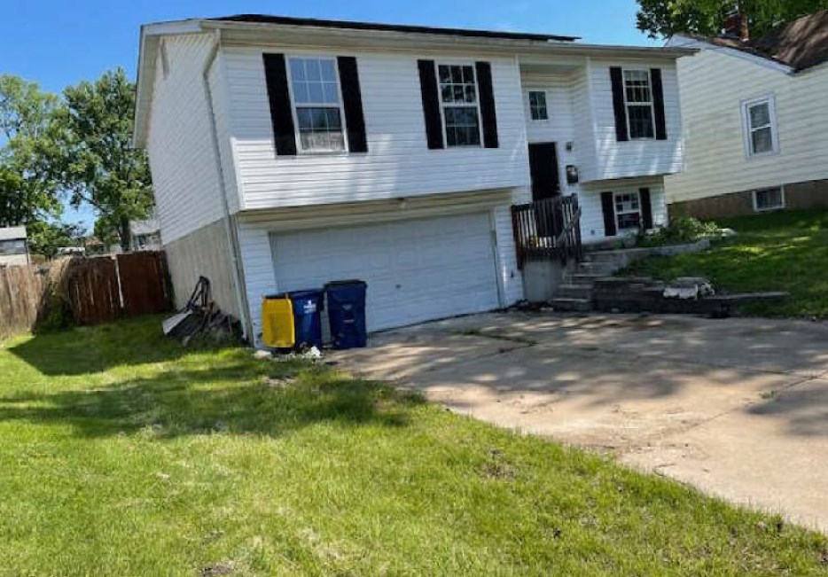
Open Public Inspections: Property can be accessed if accompanied by a Realtor. Realtor please call 800-801-8003 for access.
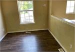
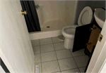
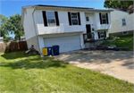
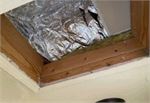
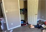
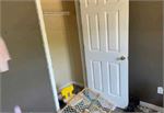
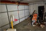
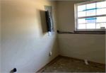
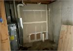
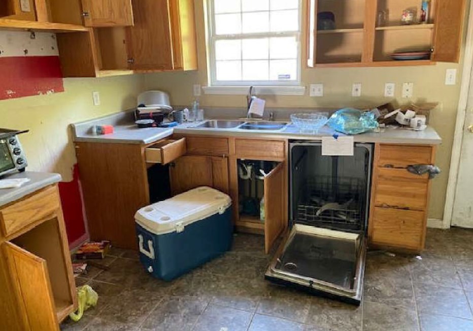
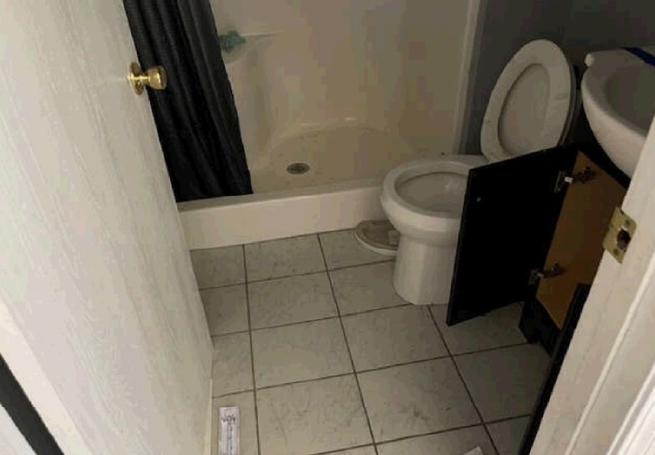
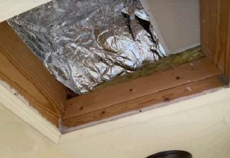
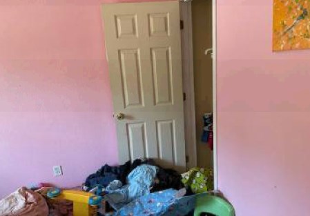
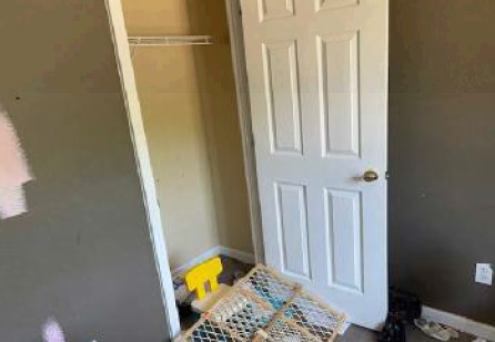
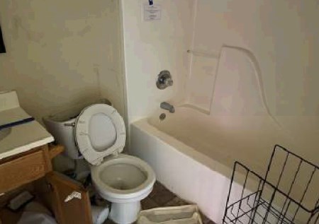
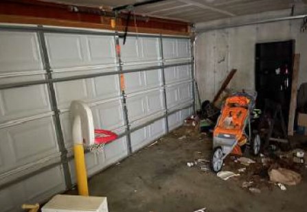
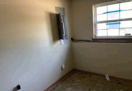
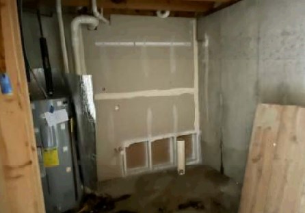
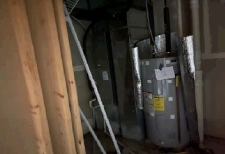
- Property is being sold in an as-is condition, and the condition is unknown and may include defects, possible health or safety hazards, or debris, or be located in a Special Flood Hazard Area.
- Proof of Funds Required. The seller requires that the high bidder be able to demonstrate proof of funds or financing pre-qualification within 24 hours of the auction. Buyer must obtain a pre-qualification letter from a lender of their choice. If buyer intends to pay with cash, a bank letter or other financial account statement showing proof of sufficient funds to cover 100% of the purchase price will be required (account numbers should be removed or redacted). Buyer understands and agrees to submit said documentation to auctioneer within 24 hours of the auction.
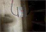
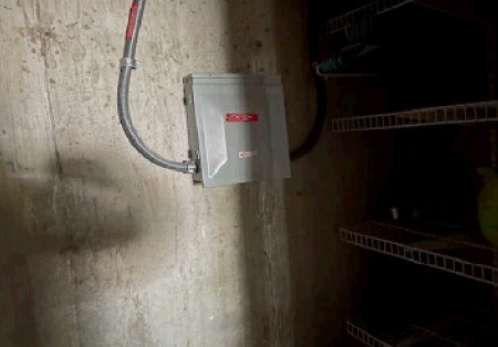
- Occupation and Utilities Disclosure. To the best of Seller’s knowledge, the property is vacant. The utilities to this property are not currently "turned on" and the property may be winterized. Utilities will not be turned on prior to closing, regardless of inspections. Buyer will need to consider this and account for it if/when inspecting the property. Buyer is responsible for utility transfer post-closing.
- Buyer understands and acknowledges that square footage, acreage, and/or bedroom and bathroom count for the building sited on the property is based on an appraisal or county assessor information. Buyer further understands and acknowledges that measurements/acreage/count can vary from a few feet to several hundred feet regardless of source (County Assessor's records, appraisal, or appraisal measurement report, etc.) and that said sources may contain erroneous information or measurements/acreage/count. Buyer should conduct their own investigation and satisfy that the size and/or square footage, acreage, and bedroom/bathroom count of the dwelling/building is acceptable to the Buyer prior to placing any bid or offer on a property.
- By placing a bid or offer on a property, Buyer is accepting the property in as-is where-is condition and agrees to be bound to the bid or offer should a discrepancy arise.
- The Buyer will be responsible for the payment of all UCC Liens of Record on the property and the clearance from the title commitment of the lien if so required.
- On this Second Chance property the foreclosure deed may not yet be recorded. Seller will make every reasonable effort to ensure the deed is filed of record as soon as possible.
ALL THAT PART OF UNITED STATE SURVEY NUMBER 416 IN TOWNSHIP 40 NORTH, RANGE 6 EAST, JEFFERSON COUNTY, MISSOURI, AND BEING DESCRIBED AS LOT NUMBER 3 AS FOLLOWS: STARTING AT AN IRON PIN ON THE NORTH LINE OF RIGHT OF WAY OF THE FRISCO RAILROAD COMPANY AT THE SOUTHEAST CORNER OF A TRACT OF LAND CONVEYED BY VALENTINE HUBER AND WIFE TO ALBERT F. WEHNER BY DEED DATED THE 20TH OF SEPTEMBER, 1933, AND RECORDED IN THE RECORDERS OFFICE IN JEFFERSON COUNTY, MISSOURI, IN BOOK 124, PAGE 413; THENCE NORTH 6 DEGREES 30 MINUTES EAST 41 FEET TO AN IRON PIN; THENCE SOUTH 82 DEGREES 30 MINUTES EAST 20 FEET TO AN IRON PIN; THENCE NORTH 6 DEGREES 30 MINUTES EAST 127.8 FEET TO AN IRON PIN; THENCE NORTH 81 DEGREES 15 MINUTES WEST 157 FEET TO AN IRON PIN; AND POINT OF BEGINNING; THENCE NORTH 6 DEGREES 30 MINUTES EAST 140.9 FEET TO AN IRON PINT; THENCE NORTH 82 DEGREES 30 MINUTES WEST 50 FEET TO AN IRON PIN; THENCE SOUTH 6 DEGREES 30 MINUTES WEST 138.7 FEET TO AN IRON PIN; THENCE SOUTH 81 DEGREES 15 MINUTES EAST 50 FEET TO AN IRON PIN AND POINT OF BEGINNING AND CONTAINING IN ALL 0.16 ACRES.
- "As-Is, Where-is", no contingencies to sale
- Close within 30 days of seller acceptance, unless otherwise disclosed below
- No Buyer's Premium
- 1% Down Payment ($1500 minimum)
- View full Terms of Sale
To learn more about auction, visit Help Center or our Frequently Asked Questions.
You can also speak with Customer Service during business hours, call 866.921.2135 or email us.