


 Print
Print Save
Save
 Share
Share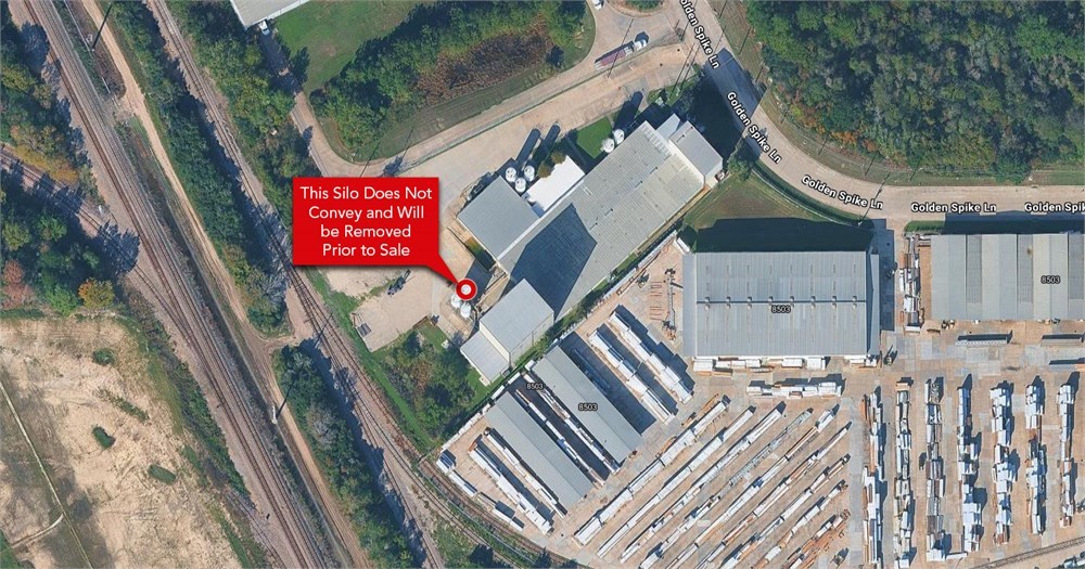
Open Public Inspections: 11-2PM Friday August 22 and September 12
- DO NOT BID unless you have read the Williams & Williams Terms & Conditions of Sale, the Contract for Sale, Property Disclosures, all available due diligence materials, and the Auction Day Notes for each property. BY PLACING YOUR BID, YOU AGREE TO BE BOUND BY THE PROPERTY SPECIFIC CONTRACT FOR SALE, DISCLOSURES, AUCTION DAY NOTES, AND THE WILLIAMS & WILLIAMS TERMS & CONDITIONS OF SALE.
- All properties are sold "AS IS, WHERE IS" with no financing, inspection or other contingencies to sale.
- Escrow. Buyer acknowledges receipt of the Joint Escrow Instructions that modifies the Contract for Sale to provide for a designated Escrow Agent to hold down payment funds. Buyer and Seller agree that the Escrow funds may be held in a trust/escrow account located outside of the state where the Property is located.
- Property Tax Disclosure Summary: Buyer Should Not Rely On The Seller's Current Property Taxes As The Amount Of Property Taxes That The Buyer May Be Obligated To Pay In The Year Subsequent To The Purchase. A Change Of Ownership Or Property Improvements Triggers Reassessments Of The Property That Could Result In Higher Property Taxes. If You Have Any Questions Concerning Valuation, Contact Property Appraiser's Office For Information.
- Square Footage/Acreage Disclosure. The source of the square footage or acreage represented for the property is from public record. Buyer understands and acknowledges that square footage or acreage measurements of a property can vary from a few feet to several hundred feet regardless of source (County Assessor's records, appraisal or appraisal measurement report, survey, etc.). Buyer shall be solely responsible for satisfying that the size and/or square footage or acreage of the property is acceptable to the Buyer.
- Personal Property Not Included. Only title to the real estate is being conveyed. Personal property may be present, but is not included in the auction. Removal of personal property remaining on site at the time of closing is the responsibility of the Buyer.
- Zone, Code, and Use Disclosure. Buyer acknowledges that the Property shall be purchased "AS-IS, WHEREIS, WITH ALL FAULTS." The Property may be subject to city, village, and/or county code or zoning violations, and Buyer accepts the property subject to any such violations. Buyer agrees to conduct an independent search of all property records in the city, county, and/or village prior to bidding and has bid accordingly. Buyer shall be responsible for any and all required remediation of the property, if any. Buyer shall not rely on any information provided by the Seller or Williams & Williams regarding the status of any code or zoning violations, and shall base its decisions on its independent inspection. Buyer also acknowledges that the property may be subject to city, village, and/or county occupancy regulations and requirements which may impact the current and/or future use of the properties. Buyer acknowledges that the seller and Williams & Williams make no warranties of any nature, express or implied, as to the permitted uses of the property, and any prohibition of buyer's intended use of the property shall not be a grounds for terminating the contract.
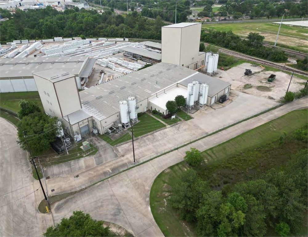
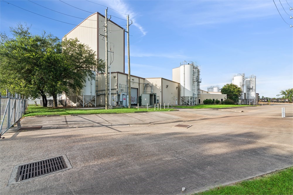
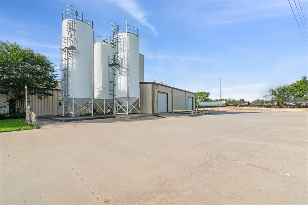
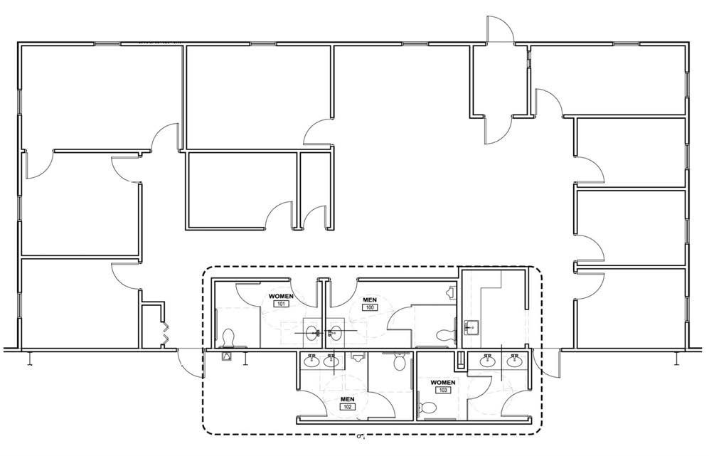
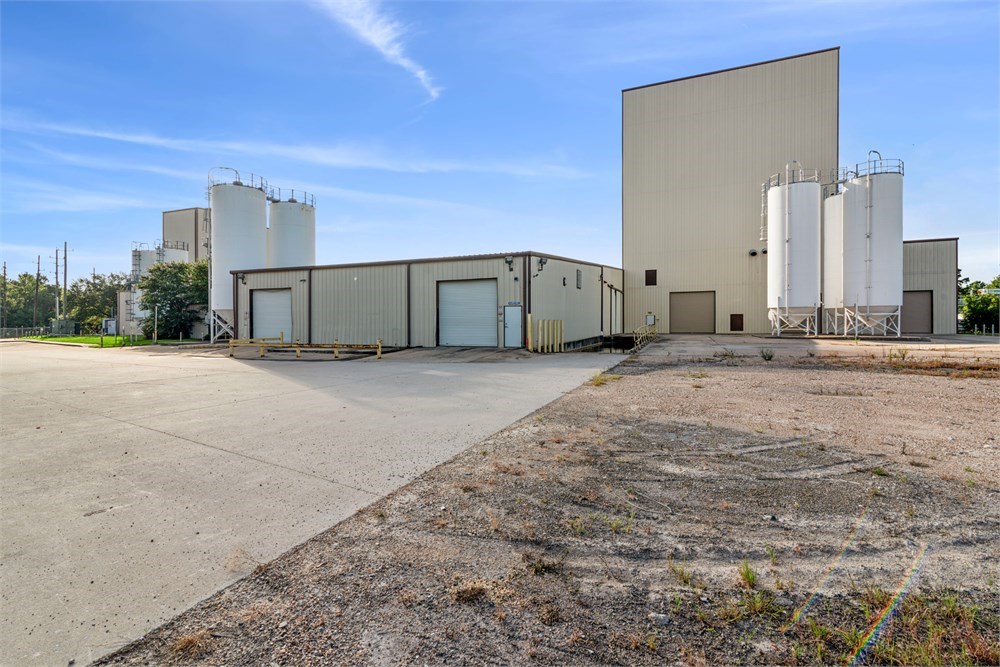
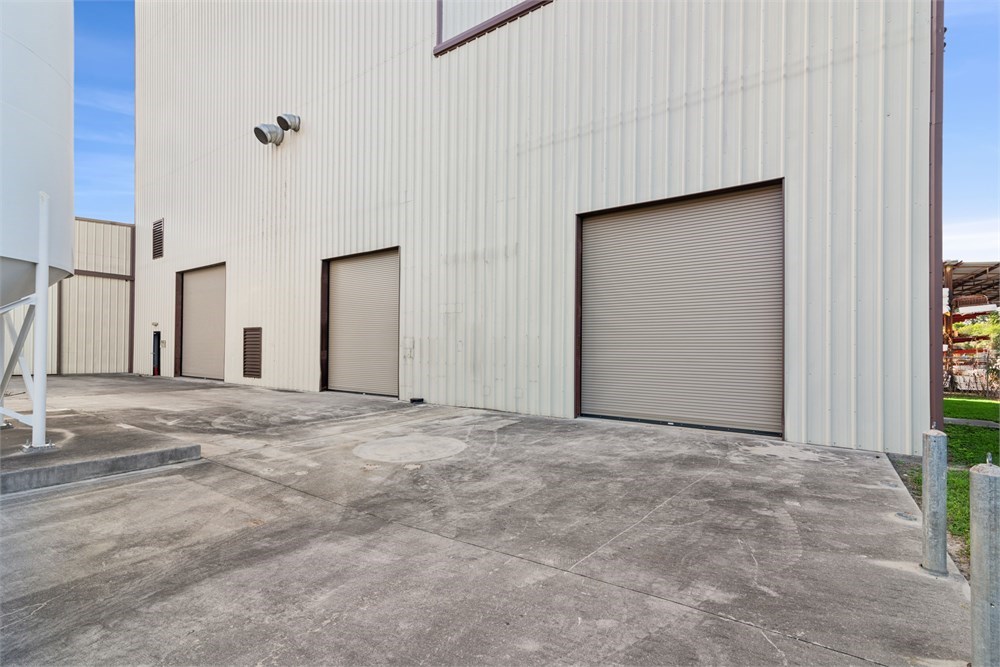
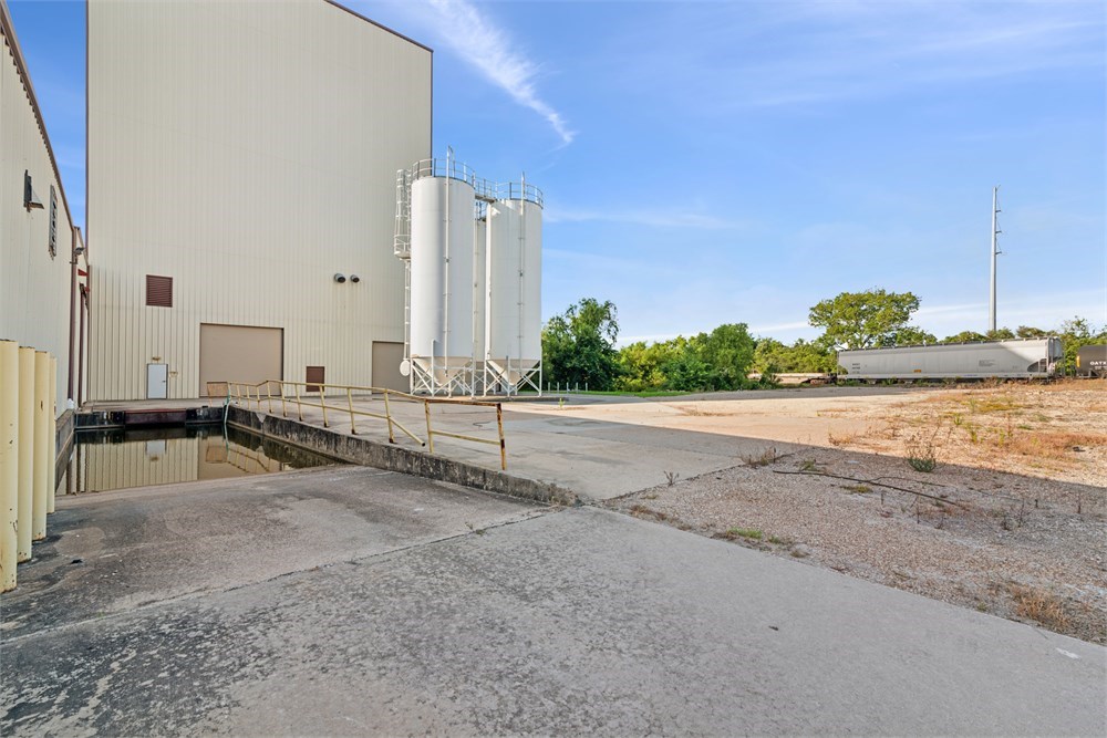
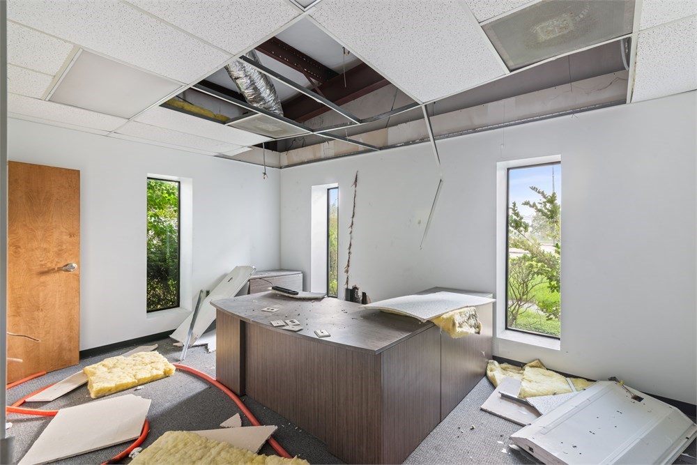
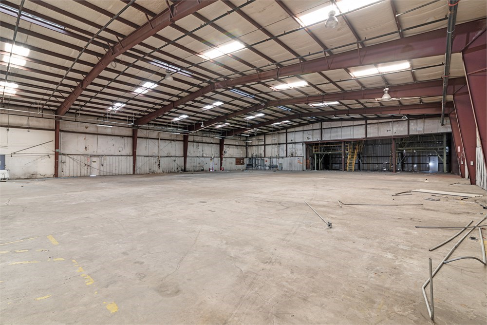
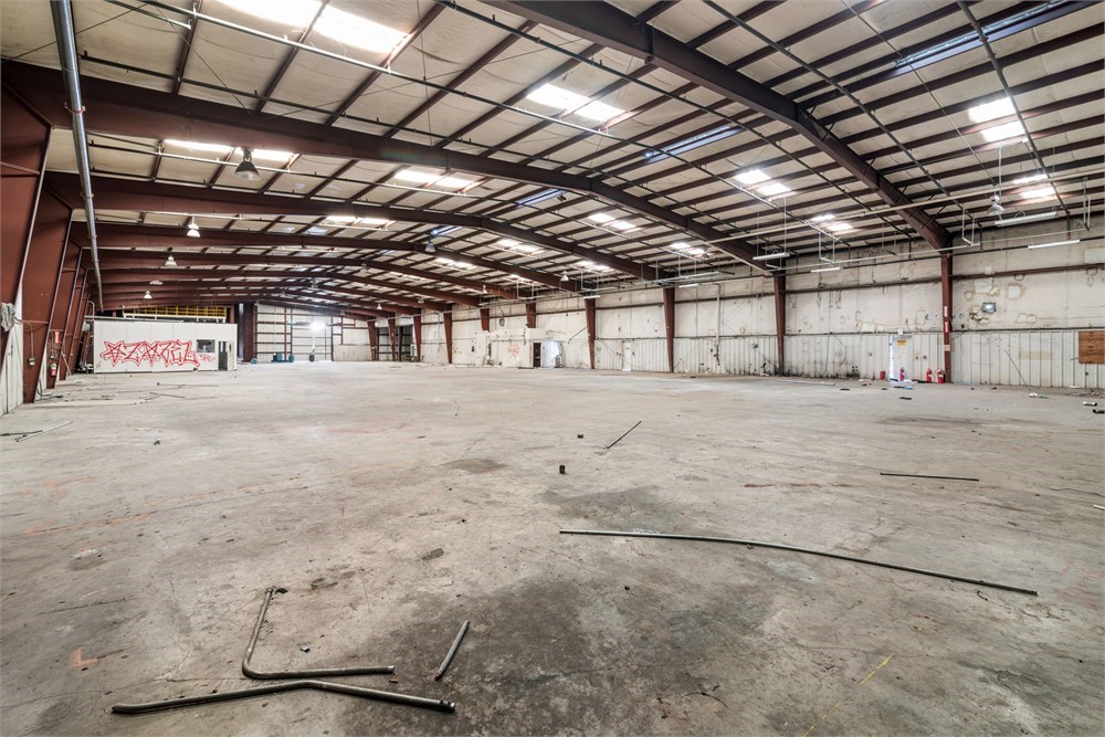
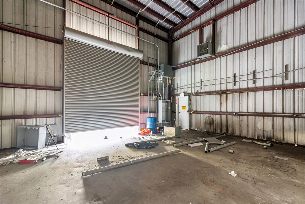
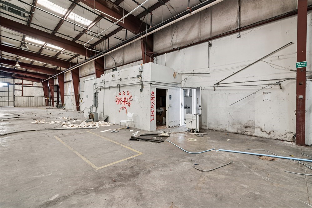
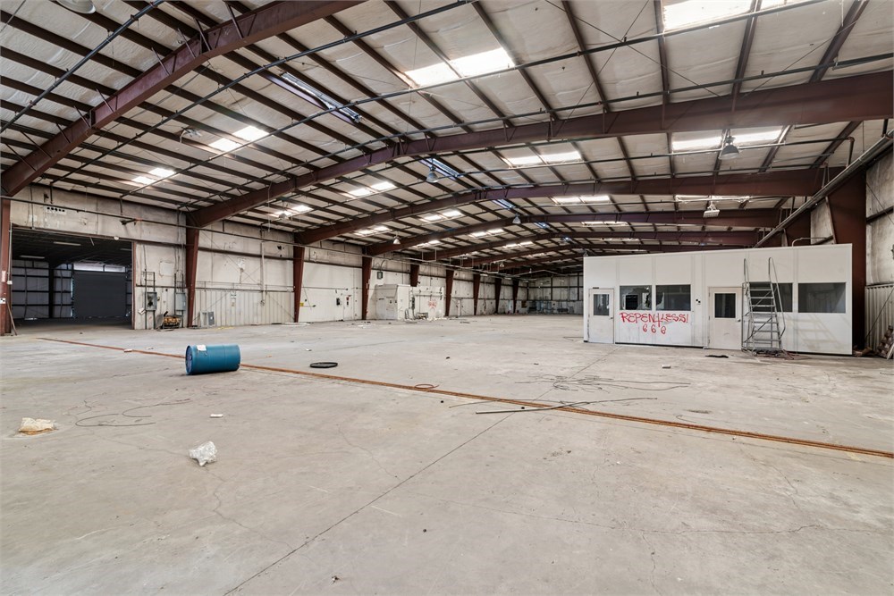
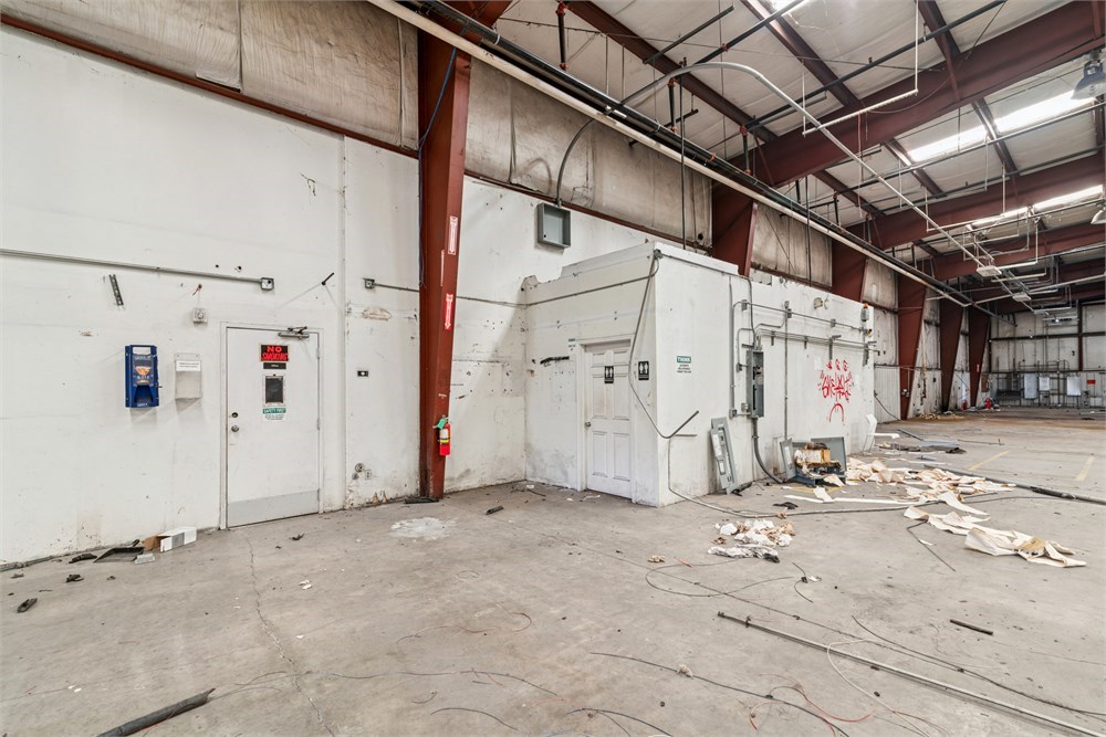
- Pictures may not reflect specific parcel, entire parcel, or current conditions of any structures that are present.
- Texas law requires that auctioneers notify consumers that consumers may contact the Texas Department of Licensing and Regulation, PO Box 12157, Austin, TX 78711 or by phone at 800-803-9202 for the purpose of making a complaint regarding a Texas auction.
- Texas Law requires all real estate license holders to give the following information about brokerage services to prospective buyers, tenants, sellers and landlords. This information is available in the Documents section of the Property Detail Page on the website.
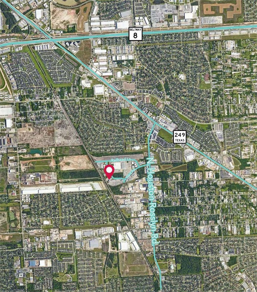
BEING a 2.860 acre tract of land in the Wiley S. Powell Survey, A-622, Harris County, Texas and being a portion of the tract described as Exhibit "A" in that certain Quit-Claim Deed from Burlington Northern Railroad Company to Glacier Park Company dated December 20, 1988, as recorded under Harris County Clerk’sFile Number(s) M105641, being part of Restricted Reserve "C" of the Burlington North industrial District, Section One as recorded in Volume 321, Page126 of the Map Records of Harris County, Texas; said 2.860 acre tract being more particularly described as follows: COMMENCING at a one inch galvanized iron pipe found for the Southwest corner of Restricted Reserve "D" of said Burlington North industrial District; THENCE, North 27 deg. 57 min. 38 sec. West, along the West line of said Restricted Reserve "D", a distance of 1428.65 feet to a point for the Northwest corner of said Restricted Reserve “D”;
THENCE, North 87 deg. 54 min. 02 sec. East, along the North line of said Restricted Reserve “D”, a distance of 51.12 feet to a 5/8 inch iron rod found for the Northeast corner of said Restricted Reserve “D”and the Northwest corner of said Restricted Reserve “C”; THENCE, South 27 deg. 57 min. 38 sec. East, along the common line between said Restricted Reserves "C" and "D", a distance of 728.25 feet to a 5/8 inch iron rod set on said common line for the POINT OF BEGINNING of the herein described tract; THENCE, North 62 deg. 02 min. 06 sec. East, across said Restricted Reserve "C", a distance of 514.05 feet to a 5/8 inch iron rod set on the common line between said Restricted Reserve "C" and Golden Spike Lane (60 feet wide); THENCE, South 27 deg. 57 min. 54 sec. East, along the common line between said right-of-way line and said Restricted Reserve "C", a distance of 91.53 feet to a 5/8 inch iron rod found on said common line for the point of curvature of a curve to the left; THENCE, Southeasterly, along said common line and along said curve to the left, having a central angle of 16 deg. 30 min. 23 sec. and a radius of 260.12 feet, for a distance of 74.94 feet to a 5/8 inch iron rod found on said curve and on said common line, for the Northwest corner of that certain called 5.0000 acre tract described in Special Warranty Deed, dated February 25, 1993, from Trillium Corporation to Macmillan Bloedel of America, Inc., recorded under Harris County Clerk's File Number P114283; THENCE, South 45 deg. 31 min. 43 sec. West, along the Northwest line of said 5.0000 acre tract, a distance of 525.32-feet to a 5/8 inch iron rod found on the common tine between said Restricted Reserves "C" and "D" for the Southwest corner of said 5.0000 acre tract;
THENCE, Northwesterly, along said common line and along said curve to the right, with a central angle of 08 deg. 09 min. 06 sec. and a radius of 554.03 feet, a distance of 78.82 feet to a 5/8 inch iron rod found on said common line for the point of tangency; THENCE, North 33 deg. 09 min. 56 sec. West, along said common line, a distance of 92.85 feet to a 5/8 inch iron rod found for an angle point in said common line; THENCE, North 27 deg. 57 min. 38 sec. West, along said common line, a distance of 144.50 feet to the POINT OF BEGINNING and containing 124,581 square feet or 2.860 acres of land.
- "As-Is, Where-is", no contingencies to sale
- Close within 30 days of seller acceptance
- 5% Buyer's Premium ($10,000 minimum)
- 10% Down Payment ($5,000 minimum)
- Technology Fee: $299
- View full Terms of Sale
To learn more about auction, visit Help Center or our Frequently Asked Questions.
You can also speak with Customer Service during business hours, call 866.921.2135 or email us.