

 Print
Print Save
Save
 Share
Share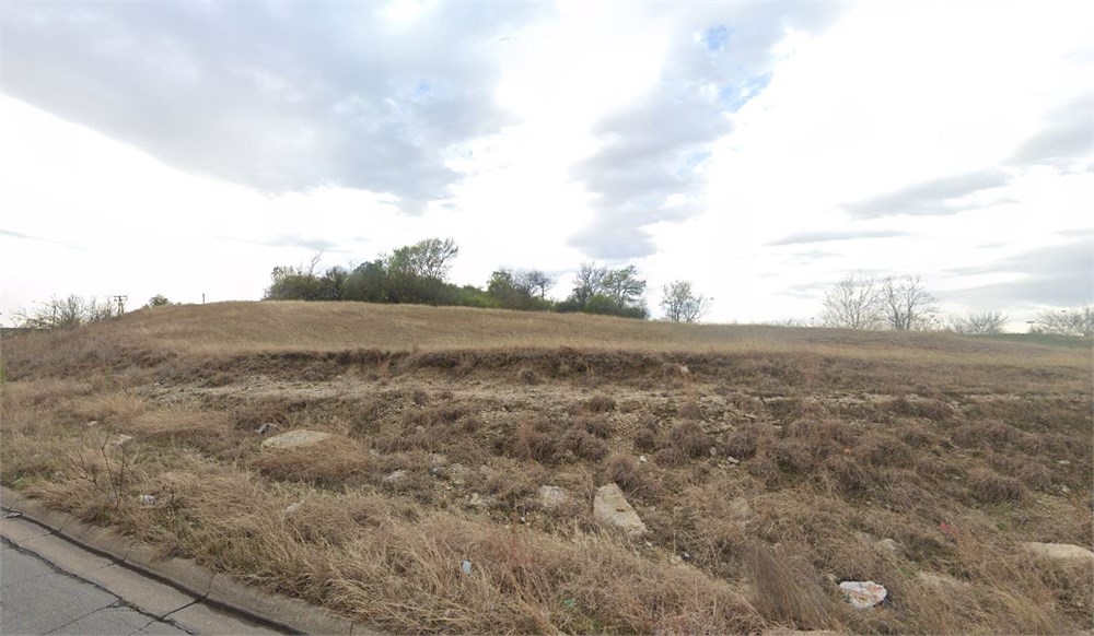
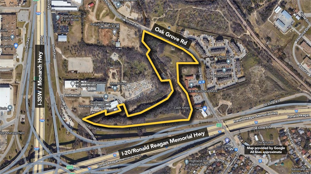
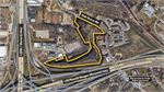
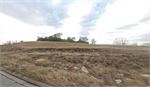
12.61+/-ac of commercial development land.
Open Public Inspections: Property can be viewed at your convenience during daylight hours.
• DO NOT BID unless you have read the Williams & Williams Terms & Conditions of Sale, the Contract for Sale, Property Disclosures, all available due diligence materials, and the Auction Day Notes for each property. BY PLACING YOUR BID, YOU AGREE TO BE BOUND BY THE PROPERTY SPECIFIC CONTRACT FOR SALE, DISCLOSURES, AUCTION DAY NOTES, AND THE WILLIAMS & WILLIAMS TERMS & CONDITIONS OF SALE.
· Deed Restriction Disclosure. Buyer understands that Seller will convey a warranty deed to the Property that includes use restrictions. Buyer acknowledges receipt of deed restriction document titled ‘Declaration of Restrictions’ and agrees to accept the conveyance document that includes the terms, conditions and restrictions set forth therein.
· Reservations - Grantor expressly reserves the rights and interests for a permanent and exclusive easement and right-of-way (“Easement”), together with all improvements located on, in, over, under, through and across the Property for the purpose of locating, establishing, constructing, laying, installing, operating, using, maintaining, inspecting, testing, protecting, cathodically protecting, repairing, assigning, restoring, renewing, reconstructing, replacing, substituting, changing, altering, converting, changing the size of, and removing pipelines, together with such appurtenant facilities as from time to time deemed by Grantor to be necessary or desirable in connection with the use and convenient operation of the pipelines and related facilities within the Easement, the location and dimensions of the Easement is further described on Exhibit B. As part of the Easement rights reserved, Grantor shall have the right of ingress and egress to and from the Easement on and across the Property and to use any road or roads located now, or in the future, on the Property, and any gates located on such roads; Grantor shall have the right from time to time to cut all trees, undergrowth, and the other obstructions that, in its judgment, may injure, endanger or interfere with the exercise by Grantor of the rights, privileges, and Easement reserved and Grantor shall not be liable for damages caused on the Easement by keeping the Easement clear of trees, undergrowth, and brush in the exercise of the rights granted; and Grantor shall have the right to cathodically protect the pipelines within the boundaries of the Easement, and to install and maintain above-ground pipeline markers, vent pipes, and cathodic protection devices, power poles and test leads within the boundaries of the Easement. Without prior written consent of the Grantor, Grantee shall not construct or permit construction within the boundaries of the Easement, and Grantor shall have the right to prevent the construction within the boundaries of the Easement, and the right to remove any and all types and sizes of houses, barns, buildings, structures, permanent impoundments of water, and natural or man-made obstructions, including trees, brush, roots and other growth. Grantee shall not, nor permit third parties to, change the grade of the Easement without Grantor’s prior written consent.
• All properties are sold "AS IS, WHERE IS" with no financing, inspection or other contingencies to sale.
• Escrow. Buyer acknowledges receipt of the Joint Escrow Instructions that modifies the Contract for Sale to provide for a designated Escrow Agent to hold down payment funds. Buyer and Seller agree that the Escrow funds may be held in a trust/escrow account located outside of the state where the Property is located.
· Property Tax Disclosure Summary: Buyer Should Not Rely On The Seller’s Current Property Taxes As The Amount Of Property Taxes That The Buyer May Be Obligated To Pay In The Year Subsequent To The Purchase. A Change Of Ownership Or Property Improvements Triggers Reassessments Of The Property That Could Result In Higher Property Taxes. If You Have Any Questions Concerning Valuation, Contact Property Appraiser’s Office For Information.
· Square Footage/Acreage Disclosure. The source of the square footage or acreage represented for the property is from public record. Buyer understands and acknowledges that square footage or acreage measurements of a property can vary from a few feet to several hundred feet regardless of source (County Assessor’s records, appraisal or appraisal measurement report, survey, etc.). Buyer shall be solely responsible for satisfying that the size and/or square footage or acreage of the property is acceptable to the Buyer.
• Personal Property Not Included. Only title to the real estate is being conveyed. Personal property may be present, but is not included in the auction. Removal of personal property remaining on site at the time of closing is the responsibility of the Buyer.
· Zone, Code, and Use Disclosure. Buyer acknowledges that the Property shall be purchased “AS-IS, WHEREIS, WITH ALL FAULTS.” The Property may be subject to city, village, and/or county code or zoning violations, and Buyer accepts the property subject to any such violations. Buyer agrees to conduct an independent search of all property records in the city, county, and/or village prior to bidding and has bid accordingly. Buyer shall be responsible for any and all required remediation of the property, if any. Buyer shall not rely on any information provided by the Seller or Williams & Williams regarding the status of any code or zoning violations, and shall base its decisions on its independent inspection. Buyer also acknowledges that the property may be subject to city, village, and/or county occupancy regulations and requirements which may impact the current and/or future use of the properties. Buyer acknowledges that the seller and Williams & Williams make no warranties of any nature, express or implied, as to the permitted uses of the property, and any prohibition of buyer’s intended use of the property shall not be a grounds for terminating the contract.
• Pictures may not reflect specific parcel, entire parcel, or current conditions of any structures that are present.
· Texas law requires that auctioneers notify consumers that consumers may contact the Texas Department of Licensing and Regulation, PO Box 12157, Austin, TX 78711 or by phone at 800-803-9202 for the purpose of making a complaint regarding a Texas auction.
· Texas Law requires all real estate license holders to give the following information about brokerage services to prospective buyers, tenants, sellers and landlords. This information is available in the Helpful Tools & Links section.
Lot 1, Block 1, ADVENTIST HILL ADDITION, an Addition to the City of Fort Worth, Tarrant County, Texas, according to plat recorded in Cabinet B, Slide 913, Deed Records of Tarrant County, Texas, TOGETHER WITH a tract of land out of the L. COHEN SURVEY, Abstract No. 290, the R. GILLASTER SURVEY, Abstract No. 619, and the JOHN H. KIRBY SURVEY, Abstract No. 2022, Tarrant County, Texas, all being more particularly described by metes and bounds as follows: SITUATED in the City of Fort Worth, Tarrant County, Texas, and being a tract of land in the LOUIS COHEN SURVEY, Abstract No. 290, the ROBERT GILLASTER SURVEY, Abstract No. 619, and the JOHN H. KIRBY SURVEY, Abstract No. 2022, and being a portion of that certain tract conveyed to the Association for Retarded Citizens of Fort Worth by deed recorded in Volume 7584, Page 19, of the Tarrant County Deed Records, and said portion being more fully described as follows: BEGINNING at a 3/4" iron rod found in place for the northwest corner of Lot 2, Block 1, Highland Hills North according to plat in Volume 388-154, Page 88, of the Tarrant County Plat Records and an angle point in said Association tract, said point being also the southwest corner of that certain tract conveyed to Land Rover, Ltd., by deed recorded in Volume 9806, Page 1468, of said Deed Records; THENCE with the easterly line of said Association tract and the westerly line of said Lot 2, the following courses and distances: South 7 degrees, 48 minutes, 55 seconds East, 100.14 feet to a 3/4" iron rod found in place for corner; South 27 degrees, 09 minutes, 05 seconds East, 180.20 feet to a 1/2" iron rod found in place for corner; and, South 7 degrees, 56 minutes, 05 seconds East, 217.57 feet to a 1/2" iron rod found in place for the southwest corner of said Lot 2 and the northwest corner of that certain tract conveyed to Bobby G. Whitehead, Sr., by deed recorded in Volume 9536, Page 2038, of said Deed Records; THENCE South 9 degrees, 39 minutes, 20 seconds West with the westerly line of said Whitehead tract, 113.42 feet to a 1/2" iron rod found in place in the southerly line of said Association tract and the northerly line of Interstate Highway 20 (Southeast Loop) [variable width right-of-way], for the southwest corner of said Whitehead tract; THENCE with said southerly line of Association tract and northerly line of I-20, the following courses and distances: North 83 degrees, 02 minutes, 30 seconds West, 214.31 feet to a Texas Department of Highways and Public Transportation (T.H.D.) monument; South 81 degrees, 53 minutes West, 702.69 feet to a T.H.D. monument; South 82 degrees, 32 minutes, 30 seconds West, 283.94 feet to a T.H.D. monument; North 73 degrees, 27 minutes, 55 seconds West, 174.11 feet to a T.H.D. monument; North 86 degrees, 10 minutes, 05 seconds West, 192.96 feet to a 5/8" iron rod found in place; North 56 degrees, 06 minutes West, 24.54 feet to a 1/2" iron rod found in place for the most westerly corner of said Association tract in the southerly line of Southside Industrial Addition, as shown on plat in Volume 388-19, Page 59, of said Plat Records; THENCE North 70 degrees, 59 minutes, 05 seconds East with a northerly line of said Association tract and said southerly line of Southside Industrial Addition, 335.86 feet to a 1/2" iron rod found in place for the northwest corner of that certain tract conveyed to Overhead Door Co. of Fort Worth, Inc., by deed in Volume 5770, Page 919, of said Deed Records; THENCE South 0 degrees, 06 minutes, 50 seconds West, 48.43 feet to a 5/8" iron rod set for the southwest corner of said Overhead Door tract on the northerly side of Sycamore Creek; THENCE North 77 degrees, 29 minutes, 10 seconds East with the southerly line of said Overhead Door tract along the northerly side of Sycamore Creek, 294.90 feet to a 5/8" iron rod set for the southeast corner of said Overhead Door tract; THENCE North 32 degrees, 27 minutes, 10 seconds West with the easterly line of said Overhead Door tract, 80.73 feet to a 1/2" iron rod found in place for the northeast corner of said Overhead Door tract in said southerly line of Southside Industrial Addition at the most easterly southwest corner of Southway Circle, a 60 foot wide public street shown on said plat; THENCE North 71 degrees, 16 minutes, 30 seconds East with the southerly end of said Southway Circle, 60.19 feet to a 1/2" iron rod found in place for the southeast corner of said Southway Circle and an angle point in the westerly line of Lot 5-A, said Southside Industrial Addition, as shown on plat in Volume 388-103, Page 915, of said Plat Records; THENCE South 32 degrees, 26 minutes, 35 seconds East with a westerly line of said Lot 5-A, crossing said Sycamore Creek and continuing with the westerly line of a certain portion of said Industrial Addition designated as "Reserved for Park Drive" on said plat in Volume 388-19, Page 59, said Plat Records, in all 160.0 feet to a 5/8" irod rod set for corner; THENCE with the southerly and easterly lines of said "Reserved for Park Drive" portion of Southside Industrial Park and northerly and westerly lines of said Association tract, the following courses and distances: North 81 degrees, 33 minutes, 25 seconds East, 245.09 feet to a 1/2" iron rod found in place for corner; North 63 degrees, 35 minutes, 40 seconds East, 176.59 feet to a 1/2" iron rod found in place for corner; North 64 degrees, 51 minutes, 15 seconds East, 250.04 feet to a 1/2" iron rod found in place for corner; North 40 degrees, 29 minutes, 40 seconds East, 99.31 feet; and North 16 degrees, 05 minutes, 25 seconds West, 194.0 feet to a 5/8" iron rod set for the northeast corner of said "Reserved for Park Drive" parcel and an angle point in said Association tract; THENCE South 89 degrees, 39 minutes, 55 seconds West with the most northerly north line of said "Reserved for Park Drive" parcel and a south line of said Association tract; 120.54 feet to a 5/8" iron rod set for the most northerly southwest corner of said Association tract and the southeast corner of that certain tract conveyed to Charles C. Crawford by deeds recorded in Volume 7752, Page 2251 and Volume 8613, Page 650, of said Deed Records;
THENCE North 33 degrees, 02 minutes, 55 seconds West with the easterly line of said Crawford tract and a westerly line of said Association tract, 283.98 feet to a 5/8" iron rod set for the southeast corner of that certain tract conveyed to Cowtown Posse by deed recorded in Volume 2361, Page 385, of said Deed Records and an angle point in said easterly line of Crawford tract and westerly line of Association tract; THENCE North 30 degrees, 13 minutes, 15 seconds West, continuing with said westerly line of Association tract and with an the easterly line of said Posse tract, 210.0 feet to a 5/8" iron rod set for the northeast corner of said Posse tract and a northwest corner of said Association tract in the south line of that certain tract conveyed to said Cowtown Posse by deed in Volume 2361, Page 382, said Deed Records; THENCE North 89 degrees, 46 minutes, 50 seconds East with the said south line of second Posse tract and a north line of said Association tract, 32.30 feet to the southeast corner of said second Posse tract and a corner in said Association tract in the channel of said Sycamore Creek; THENCE North 13 degrees, 13 minutes, 15 seconds West with a common line between said Cowtown Posse (second) tract and said Association tract, leaving said Sycamore Creek channel, 200.0 feet to a 5/8" iron rod set for an angle point in said common line; THENCE North 13 degrees, 36 minutes, 35 seconds East with said common line between Cowtown Posse and Association tracts, 74.89 feet to a 5/8" iron rod set for the most northerly northwest corner of said Association tract in the southerly line of Oak Grove Road (variable width right-of-way, 104 feet at this point); THENCE with the most northerly lines of said Association tract and said southerly line of Oak Grove Road, the following courses and distances: South 66 degrees, 07 minutes, 15 seconds East, 388.85 feet to a 1/2" iron rod found in place for an angle point in said northerly and southerly lines; South 70 degrees, 08 minutes, 45 seconds East, 170.92 feet to a 5/8" iron rod set for the beginning of a curve in said northerly and southerly lines, whose center bears South 23 degrees, 47 minutes, 20 seconds West, 361.70 feet; and, southeasterly with said curve, a distance of 263.01 feet to a 1/2" iron rod found in place for the northeast corner of said Land Rover, Ltd., tract;
THENCE South 82 degrees, 13 minutes, 25 seconds West with the north line of said Land Rover, Ltd., tract and a southerly line of said Assocation tract, 230.98 feet to a 1/2" iron rod found in place for the northwest corner of said Land Rover, Ltd., tract and an "L" corner in said Association tract;
THENCE South 7 degrees, 40 minutes, 40 seconds East with the westerly line of said Land Rover, Ltd., tract and an easterly line of said Association tract, 199.95 feet to the PLACE OF BEGINNING, and containing 12.6166 acres (549,581 square feet).
- "As-Is, Where-is," no contingencies to sale
- 5% Buyer's Premium ($10,000 minimum)
- 10% Down Payment ($5,000 minimum)
- View Full Terms of Sale
To learn more about auction, visit Help Center or our Frequently Asked Questions.
You can also speak with Customer Service during business hours, call 866.921.2135 or email us.