

 Print
Print Save
Save
 Share
Share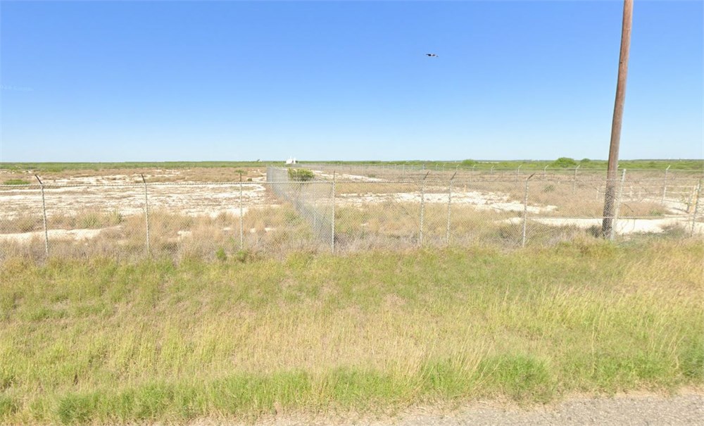
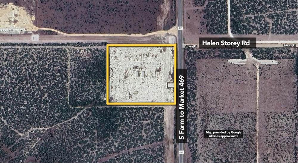
10+/-ac of commercial land.
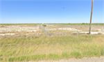
Open Public Inspections: Property can be viewed at your convenience during daylight hours.
• DO NOT BID unless you have read the Williams & Williams Terms & Conditions of Sale, the Contract for Sale, Property Disclosures, all available due diligence materials, and the Auction Day Notes for each property. BY PLACING YOUR BID, YOU AGREE TO BE BOUND BY THE PROPERTY SPECIFIC CONTRACT FOR SALE, DISCLOSURES, AUCTION DAY NOTES, AND THE WILLIAMS & WILLIAMS TERMS & CONDITIONS OF SALE.
• All properties are sold "AS IS, WHERE IS" with no financing, inspection or other contingencies to sale.
• Escrow. Buyer acknowledges receipt of the Joint Escrow Instructions that modifies the Contract for Sale to provide for a designated Escrow Agent to hold down payment funds. Buyer and Seller agree that the Escrow funds may be held in a trust/escrow account located outside of the state where the Property is located.
· Property Tax Disclosure Summary: Buyer Should Not Rely On The Seller’s Current Property Taxes As The Amount Of Property Taxes That The Buyer May Be Obligated To Pay In The Year Subsequent To The Purchase. A Change Of Ownership Or Property Improvements Triggers Reassessments Of The Property That Could Result In Higher Property Taxes. If You Have Any Questions Concerning Valuation, Contact Property Appraiser’s Office For Information.
· Square Footage/Acreage Disclosure. The source of the square footage or acreage represented for the property is from public record. Buyer understands and acknowledges that square footage or acreage measurements of a property can vary from a few feet to several hundred feet regardless of source (County Assessor’s records, appraisal or appraisal measurement report, survey, etc.). Buyer shall be solely responsible for satisfying that the size and/or square footage or acreage of the property is acceptable to the Buyer.
• Personal Property Not Included. Only title to the real estate is being conveyed. Personal property may be present, but is not included in the auction. Removal of personal property remaining on site at the time of closing is the responsibility of the Buyer.
· Zone, Code, and Use Disclosure. Buyer acknowledges that the Property shall be purchased “AS-IS, WHEREIS, WITH ALL FAULTS.” The Property may be subject to city, village, and/or county code or zoning violations, and Buyer accepts the property subject to any such violations. Buyer agrees to conduct an independent search of all property records in the city, county, and/or village prior to bidding and has bid accordingly. Buyer shall be responsible for any and all required remediation of the property, if any. Buyer shall not rely on any information provided by the Seller or Williams & Williams regarding the status of any code or zoning violations, and shall base its decisions on its independent inspection. Buyer also acknowledges that the property may be subject to city, village, and/or county occupancy regulations and requirements which may impact the current and/or future use of the properties. Buyer acknowledges that the seller and Williams & Williams make no warranties of any nature, express or implied, as to the permitted uses of the property, and any prohibition of buyer’s intended use of the property shall not be a grounds for terminating the contract.
• Pictures may not reflect specific parcel, entire parcel, or current conditions of any structures that are present.
· Texas law requires that auctioneers notify consumers that consumers may contact the Texas Department of Licensing and Regulation, PO Box 12157, Austin, TX 78711 or by phone at 800-803-9202 for the purpose of making a complaint regarding a Texas auction.
· Texas Law requires all real estate license holders to give the following information about brokerage services to prospective buyers, tenants, sellers and landlords. This information is available in the Helpful Tools & Links section.
Being 10.00 acres out of a certain called 103.44 acre tract of land recorded in Volume 236 at Page 61 of the Deed Records of La Salle County, Texas (DRLCT) and being in the name of the Heirs of Herbert Fiedler, Jr. (deceased) and the Heirs of Leander B. Fiedler (deceased). Said 10.00 acre tract being a portion of the Houston and Great Northern Railroad Company (H.& G.N.R.R.Co.) Survey No. 167, Abstract 281 and being more particularly described by metes and bounds as follows: Commencing at the Ostensible Southwest Corner of H.&G.N.R.R.Co. Survey No. 147, Abstract 271, same
being the Ostensible Northeast Corner of said Survey No. 167, calculated according to Volume N4, Page 526, DRLCT; Thence South 89°32'26" West along the Ostensible North Line of said Survey No. 167, a distance of 36.00 feet to a 5/8" capped re-bar embossed M. Meador TX 5994 set at the West Right-of-way of FM 469 (75-foot wide) according to the record TXDOT plans thereof, said point being the POINT OF BEGINNING and Northeast Corner of herein described tract; Thence South 00°014’14" East along said Right-of-way and being 40 feet at right angles westerly of and parallel with the record centerline of said highway, a distance of 500.00 feet to a 5/8" capped re-bar embossed M. Meador TX 5994 set at the Southeast Corner of herein described tract from which bears a 5" diameter concrete monument with aluminum cap (record Southeast Corner 103.44 acre tract) at a bearing of South 00°014’14" East and a distance of 2112.68 feet and at a bearing of North 89°40'43" East and a distance of 0.23 feet; Thence departing said right-of-way South 89°32'26" West parallel with aforementioned Ostensible North line and along a new line, a distance of 871.50 feet to a 5/8" capped re-bar embossed M. Meador TX 5994 set at the Southwest Corner of herein described tract; Thence North 00°14'14" West parallel with aforementioned right-of-way and along a new line, a distance of 500.00 feet to a 5/8" capped re-bar embossed M. Meador TX 5994 set at the aforementioned Ostensible
North line for the Northwest Corner of herein described tract from which bears the Ostensible Southeast Corner of H.&G.N.R.R.Co. Survey No. 169, Abstract 282, same being the Ostensible Northwest Corner of said Survey No. 167, calculated according to Volume 179, Page 287 and Volume 253, Page 6, DRLCT at a bearing of South 89°32'26" West and distance of 4386.63 feet; Thence North 89°32'26" East along said Ostensible North Line of Survey No. 167, a distance of 871.50 feet to the POINT OF BEGINNING.
- "As-Is, Where-is," no contingencies to sale
- 5% Buyer's Premium ($1,000 minimum)
- 10% Down Payment ($5,000 minimum)
- View Full Terms of Sale
To learn more about auction, visit Help Center or our Frequently Asked Questions.
You can also speak with Customer Service during business hours, call 866.921.2135 or email us.