


 Print
Print Save
Save
 Share
Share
For updates Day of Auction (bid changes, postponements and cancellations), Text "403773" to 918.362.7302.
This is an auction to foreclose a mortgage or lien and is subject to the applicable terms of sale, bidding instructions, and other conditions of sale for foreclosure auctions in the jurisdiction where the property is located. The information on williamsauction.com is provided for informational purposes only. No representations or warranties, express or implied, are made as to the accuracy or completeness of the information provided, including, without limitation, condition, attributes, and/or the value of the Property. USE OF ALL INFORMATION IS AT THE BIDDER'S RISK.
CONDUCT YOUR OWN DUE DILIGENCE. Any and all pictures and documents presented should be used for informational purposes only and may not accurately represent the foreclosed Property in its present condition, including, without limitation, the presence or condition of any structure, fixtures, plumbing, heating/air conditioning units, etc. Bidders are highly encouraged to conduct their own independent due diligence and seek independent legal counsel or brokerage or accounting advice prior to making any determination with respect to the information provided or to bid at the Auction. All Properties auctioned are sold 'AS-IS, WHEREIS, WITH ALL FAULTS AND LIMITATIONS' and without warranty of any kind or nature.
PROPERTY MAY BE OCCUPIED. DO NOT TRESSPASS. ENTRY OF THE PREMISES AND CONTACTING OR OTHERWISE DISTURBING THE OCCUPANT(S) IS PROHIBITED AND MAY SUBJECT THE VIOLATOR TO CRIMINAL AND/OR CIVIL LIABILITY.
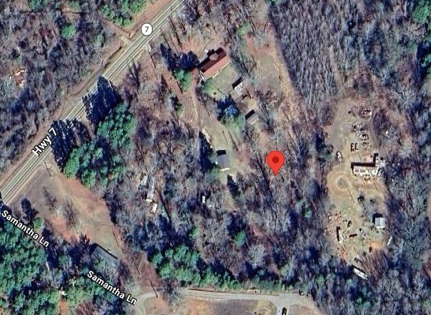
A part of the NE 1/4 of the SW 1/4 of Section 28, Township 10 North, Range 20 West, Pope County, Arkansas, more particularly described as follows: Commencing at the SW Corner of said NE 1/4 of the SW 1/4; thence South 87 degrees 00 minutes 35 seconds East, along the South line thereof, 160.00 feet to the point of beginning; thence North 02 degrees 19 minutes 27 seconds East, 317.98 feet; thence South 77 degrees 44 minutes 30 seconds West, 167.90 feet; thence North 01 degrees 47 minutes 07 seconds East, 216.33 feet to a point on the Southerly right-of-way of State Highway No. 7; thence beginning North 44 degrees 38 minutes 30 seconds East, along said right-of-way, along a curve to the right, having a radius of 2847.43 feet, and a curve length of 82.88 feet; thence leaving said right-of-way South 41 degrees 24 minutes 29 seconds East, 115.29 feet; thence South 42 degrees 07 minutes 57 seconds East, 279.77 feet; thence North 70 degrees 20 minutes 57 seconds East, 118.03 feet; thence South 0 degrees 08 minutes 30 seconds East, 318.12 feet to a point on the South line of said NE 1/4 of the SW 1/4; thence North 87 degrees 00 minutes 35 seconds West, along said South line, 290.00 feet to the Point of Beginning. Also a 30.00 foot wide easement more particularly described as commencing at the SE Corner of the above described property; thence North 0 degrees 08 minutes 30 seconds West, 15.02 feet to a point on the centerline of said 30.00 foot wide Easement; thence North 87 degrees 00 minutes 35 seconds West, along said centerline, 276.85 feet to the point of termination. Said 30.00 foot wide Easement lying 15.00 feet each side of the above described centerline. Also and subject to a 25.00 foot wide Easement more particularly described as beginning at the SW corner of the above described property; thence along the centerline of said 25.00 foot wide Easement as follows: North 02 degrees 19 minutes 27 seconds East, 317.98 feet; North 12 degrees 34 minutes 18 seconds West, 148.35 feet; North 41 degrees 24 minutes 29 seconds West, 115.29 feet to a point on the Southerly right-of-way of State Highway No. 7 and the point of termination. Said 25.00 feet wide Easement lying 12.50 feet each side of the above described centerline.
Courthouse Foreclosure Auction
To learn more about auction, visit Help Center or our Frequently Asked Questions.
You can also speak with Customer Service during business hours, call 866.921.2135 or email us.